FOUR HIKES NEAR TORONTO WE’D ACTUALLY GET UP EARLY FOR
Toronto is a very green city until you decide you want an actual hike. Then suddenly you're on the 401 with trail shoes in the back and a coffee that was supposed to last until Milton.
Fortunately, you don't need to drive three hours north to find good trails. The Niagara Escarpment gives us cliffs, forest and proper elevation surprisingly close to the city, while Rouge proves you can disappear into the woods without technically leaving Toronto at all.
For our best hiking trails near Toronto, we wanted places where the hike itself is worth making plans around. Some are easy enough for a slow Sunday outside; others will give you a few hours of hills, rocky sections and the satisfying feeling that brunch afterwards has been earned.
By CELESTE FERNER SEPTEMBER 8, 2026
HOW FAR DO YOU ACTUALLY NEED TO DRIVE?
Not as far as Toronto traffic occasionally makes it feel.
The sweet spot for hiking from the city is roughly an hour to an hour and a half away, particularly along the Niagara Escarpment west and northwest of Toronto. That's where places like Rattlesnake Point, Forks of the Credit and Mono Cliffs start feeling noticeably different from a walk through one of the city's ravines.
The bigger consideration is timing. A beautiful fall Saturday is not when we'd casually arrive at Mono Cliffs at noon and hope everything works itself out. Ontario Parks requires an advance daily vehicle permit to guarantee access at Mono Cliffs because parking is limited, and Forks of the Credit now uses advance permits and timed entry as well.
We'd leave Toronto early, especially in October. The trail is quieter, parking is easier and there's something very satisfying about already being halfway through a forest while the city is still deciding where to brunch.
MONO CLIFFS PROVINCIAL PARK — FOR THE FULL FALL HIKE
If we could choose only one proper hiking day from this list, Mono Cliffs would probably be it.
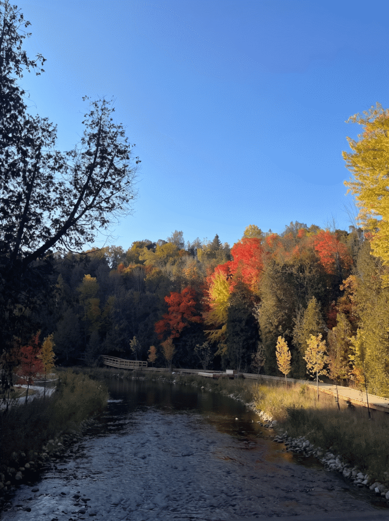
The park sits along the Niagara Escarpment north of Orangeville and has enough interconnected trails that you can build an actual morning or afternoon around them rather than walking to one lookout and immediately turning around. The landscape changes as you move through it: dense forest, rocky escarpment, boardwalk sections, open stretches and the narrow paths below the cliffs that make the park feel considerably farther from Toronto than it is.
Our move is to combine several trails rather than choose one. Walter Tovell is 4.8 km, McCarston's is 3.6 km and the Cliff-Top Side Trail adds another 2.8 km, so it's easy to put together a longer loop depending on how ambitious everyone feels that morning.
Fall is when we'd prioritize it. The escarpment covered in orange and yellow is exactly the Ontario autumn situation you want, but everyone else has had the same thought. Mono Cliffs has limited parking and Ontario Parks requires visitors to reserve a daily vehicle permit in advance to guarantee entry; permits can be booked up to five days before your visit.
Wear proper shoes if it has rained. Bring water. And don't make your first visit the middle of a peak-colour Saturday afternoon unless crowds are part of your preferred wilderness experience.
RATTLESNAKE POINT — FOR THE VIEWS
Rattlesnake Point is where we'd take someone who says they want a hike but what they really want is a very good view.
The conservation area sits on the Niagara Escarpment in Milton, with forest trails running along dramatic limestone cliffs and several lookouts over the countryside below. The ancient cedars growing out of the escarpment are part of what makes the landscape particularly beautiful; some of the trees here are hundreds of years old.
For an easier visit, the Vista Adventure Trail is 1.5 km and the Buffalo Crag Trail is 3 km. We'd choose Buffalo Crag when we want the views without turning the day into an endurance event.
If you're actually here to hike, take the Nassagaweya Canyon Trail. It's 4.7 km one way and connects Rattlesnake Point with Crawford Lake, making the return trip about 9.4 km. Conservation Halton rates it among the park's more strenuous trails and suggests allowing roughly three to four hours for the return hike.
Reservations aren't mandatory at Rattlesnake Point, but we'd still book ahead on a busy weekend. Conservation Halton recommends reservations, and booking online guarantees your spot while also reducing the gate fee.
One thing we'd take seriously here is the edge. The cliffs are part of the reason to come, but wet limestone is not interested in your photo. Stay behind the lookout barriers and save the dramatic behaviour for somewhere with fewer consequences.
FORKS OF THE CREDIT — FOR A SLOWER SUNDAY
Forks of the Credit is the hike we'd choose when we want to get out of Toronto without turning the entire day into an expedition.
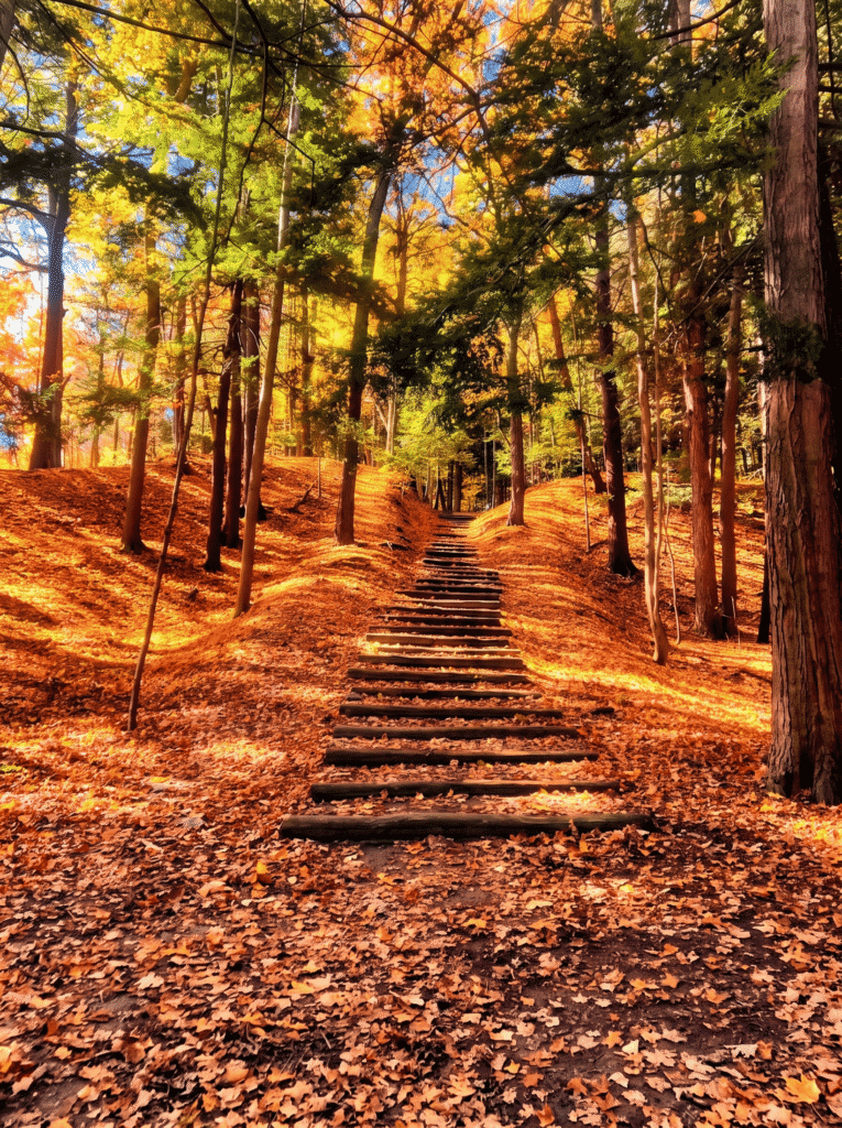
The Caledon park has a network of trails rather than one obvious route, including sections of the Bruce Trail alongside the Dominion, Kettle and Meadow trails. That makes it easy to adjust the day depending on the weather and how much walking everyone actually wants to do once you arrive.
The landscape is softer than Rattlesnake Point. Instead of dramatic escarpment-edge views, you're moving through rolling hills, woodland and meadow around the Credit River valley. There's still enough elevation to feel like a hike, particularly once you connect several trails, but this is the place we'd choose for conversation rather than personal athletic achievement.
Fall is especially beautiful here, which is also exactly why planning matters. Ontario Parks says Forks can become heavily crowded on summer and fall weekends. The park now requires advance daily vehicle permits to guarantee access, with permits released five days ahead and both four-hour and full-day options available.
We'd go early, hike for a few hours and make the rest of the day Caledon. This is less about conquering a trail and more about remembering that Ontario becomes extremely pretty approximately one hour after leaving Toronto.
ROUGE NATIONAL URBAN PARK — FOR WHEN YOU DON’T WANT THE DRIVE
Rouge is the exception to almost everything else on this list because you can get a real forest hike while still being inside Toronto.
The park stretches through forests, wetlands, farmland and river valleys on the eastern edge of the city, and its trail network is much larger than people sometimes expect. The Northeast Trail alone runs 10.7 km one way, while the Harvest Trail covers 5.1 km through agricultural fields, marsh and wooded areas.
For a first visit, though, we'd start with the Mast Trail. It's 2.3 km one way and follows a former logging route through Carolinian forest, with some genuinely steep hills along the way. Parks Canada rates it moderate to difficult depending on experience, so despite being short, it feels more like hiking than its Toronto address suggests.
Rouge is also the easiest recommendation here if you don't have a car. Just check your route before leaving because access around different sections of the park can change as infrastructure work continues. The park itself is free and open 365 days a year, with parking lots currently open from 7:30 a.m. to 9 p.m.
Bring your own water and snacks. Parks Canada currently notes that there's no running water or anywhere to buy food on the trails, which is worth knowing before discovering halfway through the hike that the tiny iced coffee you brought was not technically hydration.